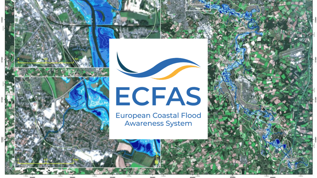
This e-module reports on the activities conducted during Task 5.5 – Mapping products that aimed at demonstrating the added value of the ECFAS products and propose adequate representation for communication and integration into the Copernicus Emergency Management Services. The deliverable includes a document and a compressed directory with ready-to-print maps, the associated geospatial datasets and symbology files.
Five Demonstration cases, corresponding each to one recent coastal event and one location, were selected to highlight the ECFAS products resulting of the coastal Flood, Impacts and Shoreline position tools developed previously during the ECFAS activities. The Mapping products prepared for each demonstration case are provided along the document in cartographic formats (ready-to-print maps), along with the symbology files and geospatial datasets that were used to create the products.
Take the Class
Study a Little
Now that you understand a little about impacts of coastal flooding, you can read a little further via the following resources:
- Copernicus Emergency Management Services webpage https://emergency.copernicus.eu/
- CEMS Rapid mapping Online Manual https://emergency.copernicus.eu/mapping/ems/online-manual-rapid-mapping-products
- CEMS Risk and Recovery Online Manual https://emergency.copernicus.eu/mapping/ems/online-manual-risk-and-recovery-mapping
- Gastal Vera, & Delbour Sebastien. (2022). ECFAS Mapping products, Deliverable 5.5 – Mapping products – ECFAS Project (GA 101004211), www.ecfas.eu [Data set]. Zenodo. https://doi.org/10.5281/zenodo.7380052
Test Yourself
For more information on the ECFAS Mapping Products see: https://www.ecfas.eu/public-deliverables/implementation-mapping-products-and-impact-assessment/