ECFAS was recently featured by Copernicus Maine Service in an article about how CMEMS data supports flood monitoring in Europe.
CMEMS implementing partner, Mercator Ocean International, has been a key partner in the development, of the ECFAS early warning system. Early detection of potentially damaging storms depends on the ability to predict extreme coastal water levels during storms, and the forecast and hindcasts contribute to these predictions, which in turn depends on being able to estimate total water levels along the coast at different times.
Copernicus Marine Service physical and wave regional operational models provide such information on total water levels and waves from models and in-situ and satellite observations. Mercator Ocean International leads the ECFAS activities dealing with coastal sea level forecasts and assessment, particularly in identifying the marine water level thresholds that could trigger coastal flooding.
You can read the full article here and find out more about how CMEMs data supports the ECFAS development.
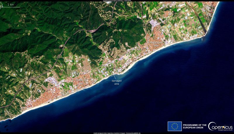
*Image: A storm surge eroded the foundations of the Maresme train line in Spain, causing sea waves to sweep away a section of the tracks. The damaged coastal area, between Pineda de Mar and Malgral de Mar, is visible in this image acquired by one of the Copernicus Sentinel-2 satellites on 2 April 2022. Copyright: European Union, Copernicus Sentinel-2 imagery.