Please note that at present, the ECFAS platform is a proof-of-concept and not an operational tool nor an operational Copernicus service. ECFAS partners provide the data “as is” and “as available” without warranty of any kind. The ECFAS partners shall not be held liable resulting from the use of the information and data provided in the platform.
The ECFAS Platform is the culmination of two-years’ work on the ECFAS European Coastal Flood Awareness System. The System is a proof-of-concept (PoC), which means it is a pilot product, developed to show that such a system is feasible. In developing the PoC, the ECFAS team was complete and detailed in its approach, meaning that the final outcome looks and feels like an existing product, although it is not
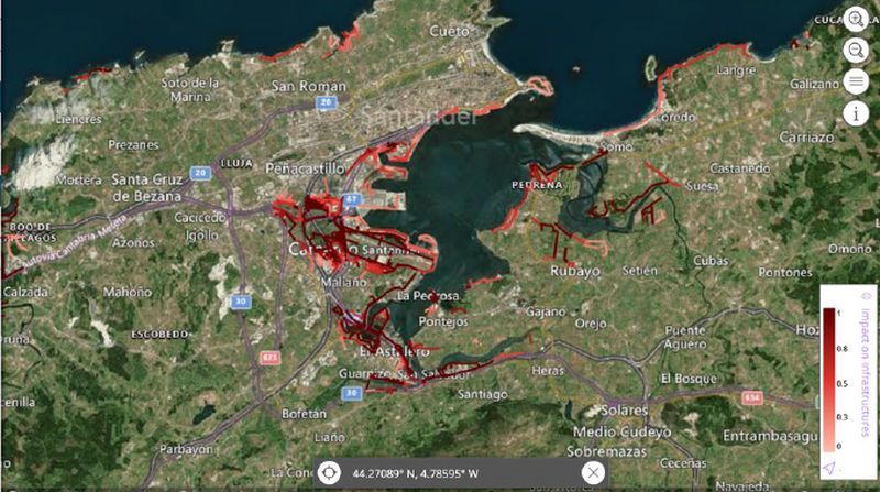
Development of the ECFAS Platform involved integrating the results of coastal exposure and vulnerability, about hindcast and forecast of Total Water Levels (TWLs) and about coastal flood awareness and impact assessment into a system deployed on a Kubernetes cluster. These were presented through the development of a web interface, designed to be easily navigated by end users, and also close to existing services but with adapted features to coastal flooding issues. The system was co-evaluated by third parties, potential end users, to improve and harmonize its functionality.
The ECFAS platform implementation, where to integrate all the developed algorithms, started with the selection of a DIAS platform, where to deploy the final system. This selection and the design of the system itself was reported in the D6.1 “ECFAS Platform architecture and design document”. The first deployment of the hosting architecture onto the DIAS server was done in January 2022, then followed by the building of the whole workflow and web interface. The official external access to the web interface was possible in June 2022. This second step was reported in D6.2 “ECFAS Platform ready for demonstration activities”.
All the software of the platform has been deployed on the WEkEO DIAS on a Kubernetes cluster. It has was packaged using Helm Chart in order to ease the deployment and the upgrade of the platform. The platform is composed of several back-end services (HTTP servers, SFTP server, WPS algorithms, databases, etc.) including a Frontend web application (web interface).
The Front End was developed on top of the CLS product called “SeeWater” https://datastore.cls.fr/products/seewater/ which is a full Front End web application which does not embed any backend services. It has been developed using Javascript technology and the https://v3.canjs.com/ library which is an open source.
For further information on the portal and its functions, you can check out these dedicated guides:
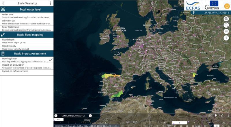
Guide 1: Computation of Total Water Level and Thresholds;
Guide 2: Flood and Impact Maps;
Guide 3: Mapping Products and Shoreline Analysis.
Check out ECFAS E-Learning Module: Navigating the ECFAS Web Interface, for a guided tour of the portal.